Tag: Maps
Photos: Accidental Geography
by Michael Yessis | 11.24.09 | 1:37 PM ET
Strange Maps just posted another amusing batch of photos where the familiar shapes of continents, countries, states and the like appear in things like shower tiles, cracks in floors, fruit and other random places. Here’s the first batch from last year. (via Coudal’s Fresh Signals)
 del.icio.us
 Digg
Digg Facebook
 Furl
Furl Ma.gnolia
 Mixx
Mixx Reddit
 StumbleUpon
 Yahoo! Buzz
Senators, Draw Your States!
by Michael Yessis | 11.17.09 | 2:44 PM ET
Love the way National Geographic is celebrating Geography Awareness Week. It invited all U.S. Senators to “draw a map of their home state from memory and to label at least three important places.” The first batch of maps are in, including one from Minnesota’s Al Franken.
Drawing his home state from memory was simple. Remember, this is the guy who can do all 50 from memory in under two minutes.
Travel Movie Watch: ‘Risk’
by Eva Holland | 11.05.09 | 11:13 AM ET
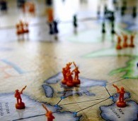
News broke yesterday that a movie version of the classic board game is in the works, with Will Smith as a producer and possible star. Blogger Colin Boyd is excited about the project, but I’m not so sure.
My favorite thing about the game was always the board itself—if you haven’t guessed that I’m a map geek by now, you haven’t been paying attention—but I can’t imagine how a movie would capture that global sweep, the bird’s-eye view of people moving across the continents. I can only hope the producers care enough about that element of the game to try.
The Best Movies of All Time, Mapped
by Eva Holland | 11.03.09 | 4:08 PM ET
Speaking of London Underground-style maps, here’s another good one: Hollywood classics, organized by genre along colored subway lines. Genius.
Mapped: The U.S. Interstates, in the Style of the London Underground Map
by Michael Yessis | 11.03.09 | 10:21 AM ET
See it in Senex Prime’s Flickr stream. (Via Coudal)
How the Waldseemüller Map Changed the Universe
by Michael Yessis | 10.16.09 | 2:43 PM ET
The Waldseemüller map was the first map to identify America, and as Toby Lester writes, it played a great role in Nicholas Copernicus’ argument that the earth revolves around the sun.
Mapped: The Cheeses of Britain and Ireland
by Eva Holland | 10.08.09 | 10:57 AM ET
Another tasty bite of geographical fun—and more proof that British food is worth defending. (Via @LPUSAstaff)
New Travel Book: ‘Strange Maps: An Atlas of Cartographic Curiosities’
by Eva Holland | 10.06.09 | 11:33 AM ET
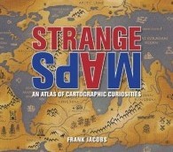
We know there’s no shortage of odd and innovative maps out there these days—and now, a new book aims to collect some of the best. This “atlas of cartographic curiosities” comes from Frank Jacobs, the author of the Strange Maps blog, and it mixes everything from inaccurate historical maps to satirical cartoon maps, map mash-ups, maps of fictional literary settings and more. Book Bencher Jenna Krajeski calls the book “a peculiar and delightful compiling of disparately obsessive imaginations, selected on the criteria of strangeness, rarity, and originality.”
“Strange Maps” hits bookstores on October 29.
The World’s Connections, Mapped
by Eva Holland | 09.30.09 | 3:30 PM ET
The New Scientist has a fantastic slideshow of world maps, showing global shipping lanes, railways, navigable rivers and more. The idea? To demonstrate how “little of the world’s land can now be thought of as inaccessible.” (Via The Morning News)
McDonald’s in America, Mapped
by Eva Holland | 09.25.09 | 12:59 PM ET
Check out this cool (if slightly disturbing) map of every McD’s location in the lower 48—where, apparently, you’re never more than 107 miles away from the nearest Big Mac.
Al Franken Draws a Map of America
by Eva Holland | 09.09.09 | 1:12 PM ET
From memory. Apparently the good Senator’s been pulling out this party trick for years, but his latest display—presumably, his first since taking office—is drawing a lot of online attention. Here it is, from the Minnesota State Fair:
Hey, wouldn’t it be nifty if an excellent grasp of the country’s geography was a prerequisite for federal office, rather than a viral video-worthy feat?
Mapping Manhattan in 1609
by Eva Holland | 09.03.09 | 12:32 PM ET
Union Square in the early 17th century? According to The Mannahatta Project, an interactive map that lets users search block-by-block for the ecological and wildlife history of Manhattan, it was home to the meadow vole and the white-footed mouse, rather than the Greenmarket browsers of today. (Via Boing Boing)
Book Bannings in America, Mapped
by Eva Holland | 09.01.09 | 1:25 PM ET
Banned Books Week has a mashup of all the book bans (and resulting challenges) in the Lower 48 over the last two years. Anyone expecting a certain, er, geographical censorship concentration might be in for a surprise: Brooklyn and the Bay Area, for instance, are represented right alongside the more stereotypical suspects. (Via The Book Bench)
The Warm Bacon-y Wind of New York City
by Michael Yessis | 08.31.09 | 12:05 PM ET

Jason Logan walked New York City from tip to tip, chronicling the smells of his journey in a fantastic New York Times Op-Art piece. It looked great in print yesterday. Online, it’s better—and interactive. Click on TriBeCa and you’ll find out that while he was there Logan smelled, among other things, deep-fried something, faux-leather fanny pack and a warm bacon-y wind.
There’s great detail throughout. For instance, roll over the map and your cursor turns into a nose.
‘The Island of California’ and Other Ancient Maps
by Eva Holland | 08.27.09 | 12:19 PM ET
Check out this roundup of unusual historical maps from Free.edu. I can’t decide which I like best: the ones with familiar places rendered unrecognizable, like the misnamed 17th-century “Modern and Completely Correct Map of the Entire World,” or the 1886 “Map of Venice”—which, to my eye, seems virtually identical to the handouts at the tourist office there today. (Via Kottke)
Google Mapping the Alphabet
by Eva Holland | 07.27.09 | 12:41 PM ET
Over at the Daily Dish, Chris Bodenner has come across a collection of Google map terrain views—all from New York state—that appear to spell out the alphabet. Just one more way that Google is helping to shrink the planet?
Mapped: Literary San Francisco
by Michael Yessis | 07.21.09 | 10:28 AM ET
The San Francisco Chronicle commissioned a beautiful map of San Francisco “composed of some of the very words—from novels, poems and essays—that animate our city.” It’s “loosely inspired” by the literary map of St. Petersburg, Russia, we linked to in February. (via @roncharles)
New Satellite Map of Earth Unveiled
by Eva Holland | 07.01.09 | 10:05 AM ET
The latest terrain map, a collaboration between NASA and the Japanese government, offers coverage of 99 percent of the planet’s surface. The best previous effort managed 80 percent.
Mapped: How Hollywood Sees the United States
by Michael Yessis | 06.26.09 | 10:33 AM ET
What, you’ve never been to Alabanjorape?
Morning Links: The Cuba Travel Showdown, Pirates and More
by Michael Yessis | 03.11.09 | 9:46 AM ET
- The Senate passed a bill to ease travel and trade to Cuba—but the showdown over U.S. policy isn’t over yet.
- A man sued American Airlines for $7 million, saying the carrier “illegally revoked his lifetime pass.”
- Here’s an interesting combination: William Langewiesche, a French luxury cruise ship and pirates.
- Registration for this year’s tours of Washington’s Hanford nuclear site begins March 30.
- Police in China are feeding drivers raw chilli to help them stay awake on the roads in the Chongqing region.
- Goodbye, Travel + Leisure Golf.
- Amina Chaudary says she’s the only Muslim to whom Samuel Huntington gave a formal interview. She writes about “The Clash of Civilizations” author’s legacy at PostGlobal.
- For map geeks: Bloopers from a New York Times map and graphics editor. (via The Morning News)
- Timers on postcards? Isn’t the cancellation stamp enough? (via Coudal)
Got a suggestion? .(JavaScript must be enabled to view this email address) your link.